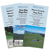
Hard Copy or PDF. Either way we'll give you the Tahoe set for FREE

Hard Copy Map Sets

Bay Area Mountain Bike Trails

Bay Area Mountain Bike Maps
PDF Map Sets

Bay Area Mountain Bike Trails

Marin Headlands Mountain Bike Trail Map

Discover the best mountain bike trails in the Marin Headlands

Marin Headlands Area Summary

Location: Near Mill Valley
Best For: Intermediates
Suitable For: All levels except extreme
Ground Cover: Mostly open grasslands and scrub
Seasons: Good year round. Dress in layers...can be foggy and cold even in the middle of summer.

Description:
Picturesque Marin Headlands combines great trails, incredible scenery, wildlife and the convenience of being just a few miles from San Francisco. With grass-and-scrub covered ridgetops opening up to beautiful ocean and city views, these trails are heavily used by a variety of groups. Please use caution and obey posted signs to help maintain the fragile peace that exists in Marin among trail user groups.

The headlands' moderately steep fire roads and wide single-track trails are perfect for strong intermediate riders. Intrepid beginners might want to tackle the first featured ride or the very flat Tennessee Valley Trail, while hardcore riders looking for a challenge may need to ride elsewhere.

The featured rides both begin from Tennessee Valley Road. However, it is also possible to reach the area from the Golden Gate Bridge via Bunker Road.

Click here to preview the Marin Headlands Mountain Biking Map

Marin Headlands Bike Trails

Beginner Level Trails

Tennessee Valley Trail - open fire road to beach.

Intermediate Level Trails

Miwok Trail - Scenic fire road and wide single-track.
Marincello Trail - Wide fire road. Bay views up top.
Bobcat Trail - Fire road through open grasslands.
Old Springs Trail - Wide, moderately technical single-track.
Diaz Ridge Trail - Fire road up top, (newly reoriented) and fairly mellow single-track below. Great ocean views.
Middle Green Gulch Trail - Single-track climbs through scenic grassland area. Uphill only.
Coyote Ridge Trail - Ridgetop fire road.
Coastal Trail - Another fire road with great ocean views.

Directions to trailhead(s):

The main parking is located just 15 minutes' drive north of the Golden Gate Bridge at the end of Tennessee Valley Road. From Highway 101, take the Highway 1 exit heading north. Tennessee Valley Road is a quick left off Hwy 1. Access to trails also from Bunker Road and Muir Beach.