|
||||||
|---|---|---|---|---|---|---|
Henry Coe State Park Mountain Bike Trail MapGuide to the best mountain
bike trails in the northern
|
|---|
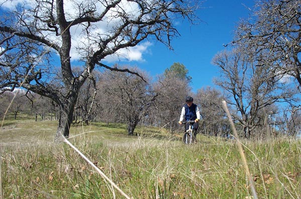
Area Summary The park's northern section, which includes a developed campground and visitors center, features the Middle Ridge Loop, a classic Coe ride that should be on any advanced intermediate rider's "must do" list. The single-track is beautiful and challenging, but the payback is a nasty climb up from Poverty Flat to end the ride. The featured rides are great starting points, but Coe begs to be explored, with miles of fire roads and single-track crisscrossing its vast expanse. Hit the campgrounds for a spring weekend to get more riding "bang" for your driving "buck" and you'll get to experience the best Coe has to offer. |
| The trail map below is a jpeg of the actual maps from our books and map-sets.
|
| Henry Coe State Park is just one of the huge variety of mountain biking spots that the Bay Area has to offer. Discover more great rides. |
Henry Coe Bike Trails Middle Ridge Trail - begins as fun rolling single-track through oak woodlands before descending steeply. Flat Frog Trail - narrow, though never steep, single-track China Hole Trail - well graded single-track through manzanita, oak woodlands and grasslands. Jackass Trail - steep single-track connects Blue Ridge and Poverty Flat fire roads via Miller Field Note: All fire roads in the northern section contain steep rutted sections. Parts of Hobbs Road and Poverty Flat Road are particularly nasty and will usually require some hike-a-bike. Directions to trailhead(s): |