Hard Copy or PDF. Either way we'll give you the Tahoe set for FREE

Hard Copy Map Sets

Bay Area Mountain Bike Trails

Bay Area Mountain Bike Maps
PDF Map Sets

Bay Area Mountain Bike Trails

Bolinas Ridge - Mountain Bike Map

Discover the best mountain bike trails in Western Marin County

Bolinas Ridge Mountain Biking


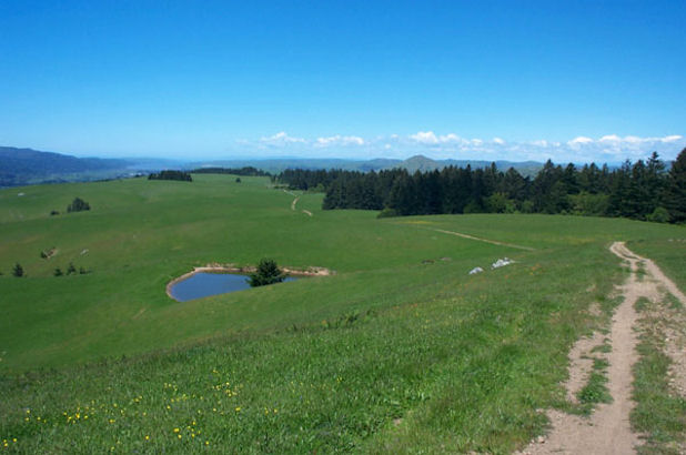
Area Summary
Location: Point Reyes vicinity
Best For: Intermediates
Suitable For: All levels except extreme
Ground Cover: Open pastureland and dense redwood forest
Seasons: Good year round. Can be muddy in winter.

Description:
Bolinas Ridge is an ideal "get-away-from-it-all" Mountain Biking area. Located in a sparsely populated area of Marin just east of Point Reyes, Bolinas Ridge offers beautiful rolling fire roads through open pasturelands and dense redwood forests. While the area does include one single-track trail, the riding is not overly technical.

The two featured rides share the Bolinas Ridge Trail, with Ride 1 descending to the beautiful, though often overgrown, Olema Valley Trail, while Ride 2 heads towards the redwoods of Samuel Taylor State Park.
While the loops are both strenuous, the Bolinas Ridge Trail can also be an excellent out-and-back ride, allowing strong beginners the opportunity to get a taste of mountain biking while enjoying the awesome scenery.

Click here to preview the Bolinas Ridge Mountain Biking Map

Directions to trailhead(s):

Bolinas Ridge is about an hour's drive north of San Francisco. Take the Sir Francis Drake Blvd. exit (toward San Anselmo) from Hwy 101 and head west for about 16 miles to reach the main Samuel Taylor State Park entrance or 19 miles for the Bolinas Ridge trailhead. Additional access to this area is available along Hwy 1 at Bolinas or Five Brooks Stables.