|
||||||
|---|---|---|---|---|---|---|
Briones - East Bay Open Space Mountain Biking Trails |
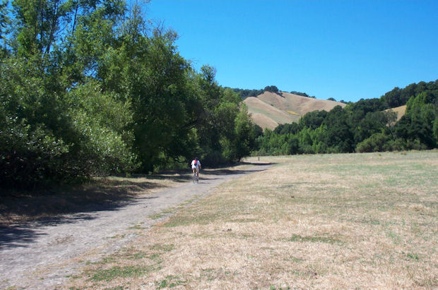
Briones Regional Park, a holding of the East Bay Regional Park District, is decidedly more remote than its developed siblings in the Berkeley and Oakland hills. The 6,000-plus-acre Briones has an open feel that befits its origins as a large cattle ranch dating back to the early 1800s. Like all areas in the East Bay park system, Briones lacks open single-track trails, but makes up for it with a vast network of fun and scenic fire roads. The number of loop rides you can create is almost endless. The scenery is classic California, with wide open grasslands punctuated by stands of oak trees. The fire roads at Briones are invariably steep though generally not technical, making for a great work-out for strong riders. Less fit riders should definitely stay clear, and all riders should beware of brutal midday heat on many summer days. |
| Check out our interactive Map of Briones Open Space |
Briones Bike Trails Beginner Level Trails Abrigo Valley Trail - Gravelly, gently graded fire road. Intermediate Level Trails Briones Crest Trail - Long, steeply rolling fire road meanders along the ridgetops. Great views of Mount Diablo. Advanced Level Trails Lafayette Ridge Trail - Steeply rolling fire road through open terrain. Briones Regional Park is located in the open space between Lafayette, Pleasant Hill and Orinda. The main parking area is off of Bear Creek Road. From Hwy. 24 take the Orinda exit, follow Camino Pablo north for 2 miles, and turn right on Bear Creek Rd. The main entrance to Briones is 4.5 miles down Bear Creek on the right. Additional entrances are off of Alhambra Valley Road and Reliez Valley Road near Pleasant Hill. |